Friss tételek
A következő címkéjű bejegyzések mutatása: angol. Összes bejegyzés megjelenítése

Post office


I live in Tiszaszentimre. It is a village but there is a post office.
When I last went to the post office I send a letter to my godparents and buy a magazine. I can send  my friends postcards for their birthday or their weddings.

Shopping in a clothes shop


I like shopping. My appearance is most important for me. Furthermore I love fashionable clothes.
Sometimes I go shopping alone, but usually my friend or my mum comes with me. I prefer shopping for clothes with a friend as it’s too difficult for me to choose and decide alone. I need her help and I trust her taste.

Friends

My friends are very important in my life. I have got a lot of friends. We always go out at the weekends together. Most of them are my classmates so we meet almost every day at school. We are talking during the breaks and always do something funny.

Family everyday life


I have relatively large family : my parents, a younger brother and grandfather.
My father is 48 years old. He is a tall man with lank brown hair and brown eyes.He works at a big international company. He's very busy. My mother is 40 years old. She is a short woman with curly black hair, and brown eyes.

Topic: Personal data - Important stages of candidate’s life


Would you please speak about yourself, your childhood and school years?
1)      When and where were you born?
     I was born on the 26th on August 1993 in Debrecen
2)      What did you do in kindergarten / at nursery school? What games did you play?
    After creche, I went to nursery school, which I liked very much because I could   play with a lot of  children and there was lots of interesting playground equipment.
My favourites were jungle gym, swings and sandpit.
We had lovely nursery school teachers, who prepared us for the school brilliantly.

The countries of Africa (Egypt and the South African Republic)

Egypt

Two-third of the area of Egypt is covered by desert. The arable lands lie on the two coasts of the River Nile where 55 million inhabitants live. The Capital is Cairo, the „city of mosques”. (There are 500 mosques and minarets in Cairo.) The official language is arabian, the most widespread religion is the Muslim.

Natural resources in Hungary


Is our country country rich or poor in natural resources?
The answer is not definite. We are abound in soils and water resources. However, we have just little energy resources and unfortunately several minerals of which we cannot extract anything.

Global Warming


From the 20th century the warming of the air is continously strenghtening.The deforestation and the desertification also help the warming of the air because CO2 in 50% is responsible for global warming.
The role of the ozone layer is decisive because if the ozone layer hurts the ultraviolet radiation can reach the earth’s surface which destruct human beings.

The atmosphere


Composition:

The atmosphere is a mixture of different gases, but it also contains particles in liquid and solid states.

The energy policy of the world


The operation of the economy and the life of the society would be unimaginable without power generation.

Economical and social characterization of region of the North Great Plain


Society:

-population: 1,550,000 people
-population density: 87.5 p/
-population of the North Great Plain is constant the annual variation is only 0.03%.
-unemployment: 90,000 people are not employed
-there are not small cities: people live in villages and large cities,
  this evolved under the Turkish Reign
-Gipsy population is about 50,000
-religion.-1,150,000 people are members of a religious group
- the most popular churches-Catholic /550,000 p./   
-Calvinist /550,000 p./

The Global Air Circulation


On the sphere-shaped gömb alakú Earth warming up differs at the different places. It is the strongest along the Equator, and the weakest at the poles, and due to this the air pressure is low at the Equator and high at the poles. Low pressure zones form in the district of the latitude 60 and high pressure zones around the latitude 30. Due to the cyclones and anticyclones forming in the jet streams, the moving of the air is ascending (low-pressured zones) and descending (high-p.z.).

Europe


Europe lies mainly ont he northern and eastern hemisphere, but a little part of it lies ont he western one as well. Europe ont he east tightly belongs to Asia that is why it is sometimes called the peninsula of Asia. Their common name is Eurasia.

Lakes


Definition:
Open-surfaced stagnant water that fills a depression that is closed from every                       
                  side.

Economical and social characterization of region of the North Great Plain


Society:

  • population: 1,550,000 people
  • population density: 87.5 p/
  • population of the North Great Plain is constant the annual variation is only 0.03%.
  • unemployment: 90,000 people are not employed
  • there are not small cities: people live in villages and large cities,  this evolved under the Turkish Reign
  • Gipsy population is about 50,000
  • religion.-1,150,000 people are members of a religious group
  •  the most popular churches-Catholic /550,000 p./   
  • Calvinist /550,000 p./
Economy:
  • landscape: it is a plain, so the variation of height not reaches 200m
  • it is poor in minerals /except some recourses/ 
  • it has good soil and climate
  • agriculture and processing industry, which settled on it, is developed
  • the development of the infrastructure is under the territorial (országos) average   

Counties of the North Plain:-Szabolcs-Szatmár-Bereg county
  • Hajdú-Bihar county
  • Jász-Nagykun-Szolnok county

There are big differences between the counties inside the region.:
  • H.-B. c.:-It has multi-faceted agriculture and industry.
  • Debrecen has central role.
  • J.-N.-Sz. c.:-Mean developed (közepesen fejlett) area.
  • Sz.-Sz.-B. c.:-It is at a disadvantage (hátrányos helyzetben van).-small settlements
  • high rate of unemployment
  • unfavourable soil attributes (talajadottságok)
Hajdú-Bihar County:

Minerals (ásványkincsek):
  • the natural gas extraction (kitermelés) is significant and there is a bit mineral oil extraction 
Industry:-industry is settled in the cities
  • Debrecen has multi-faced industry:-chemical-, food-, press industry and production of agricultural machines and bearing (csapágy)
  • Other cities with factories:-Hajdúszoboszló-chemical industry
  • Téglás-production of machines
Agriculture:-in this county agriculture has an important role
  • main cultivated plants:-wheat
  • corn
  • potato
  • sugar-beet
  •  animal breeding:-cow-9% of the Hungarian substance is in this county
  •  swine-10%
  •  sheep-20%
Jász-Nagykun-Szolnok County:

Minerals:
  • extraction of the natural gas and mineral oil is should be noted
  • extraction of raw materials of the building industry is significant-sand
  • clay
Industry:
  • it is settled in the cities
  • leading branches:-machine industry-Jászberény
  • Szolnok
  • food industry-poultry processing-Törökszentmiklós
  • milk industry-Tiszafüred
  • mill industry-Törökszentmiklós
  • sugar industry-Szolnok
  • vegetable oil and bier production-Martfű
  • baking industry-Szolnok
  • other existing branches in this county: -chemical industry-Szolnok
  • paper industry-Szolnok
  • furniture industry-Szolnok
  • shoe production-Martfű
Agriculture:-in this county agriculture has an important role
  • main cultivated plants:-wheat
  • sunflower
  • corn
  • sugar-beet
  • alfalfa (lucerna)
  • rice-90% of the Hungarian rice casting area (vetőterület) is in this county
  • animal breeding: -there is about 7-8% of the Hungarian substance of swine, cow and sheep
  • there are about 4000 horses
  • and more than one million poultries
Szabolcs-Szatmár-Bereg County:
Minerals:
  • only sand, and clay are extracted in this county

Industry:
  • leading branch:-food industry-Kisvárda
  • other important branches in this county:-chemical industry
  • textile industry
  • machine industry
  • wood industry-Vásárosnamény
  • Tuzsér
  • centres of the industry:-Nyíregyháza:-food industry
  • gum industry (gumiipar)
  • Tiszavasvári:-medical industry
  • Nyírbátor:-shoe industry
  • Záhony:-its industry is built on the border traffic
Agriculture:
  • main cultivated plants:-field (szántóföldi) plants-wheat, corn, sugar-beet and potato
  • fruits-apple, plum, cherry and nut
  • animal breeding:-there is about 5% of the Hungarian substance of swine and cow
  • there is 16.5% of the Hungarian substance of sheep 
  • there is about 6.5% of the Hungarian substance of poultry

Earthquake


Earthquake is a movement of the crust. About 150, 000 earthquakes can be sensed yearly without instruments, these movements are the macro seismic quakes (
makroszeizmikus rengés). And there are 1 million, which is only detectable with instruments, these are the micro seismic quakes (mikroszeizmikus rengés). 90% of the earthquakes are connected with the margins of plates, similarly to active volcanoes. And because of this, on a map the epicentres show these lines. The other 10% are caused by eruption of volcanoes, and the collapse of underground cavities (üreg). The hypocentre is the underground site, from which earthquakes waves originate. The epicentre is the area of the surface directly above the hypocentre /focus/ o fan earthquake. We can make a difference among three types of the earthquakes: shallow-focused (sekély fészkű) /0-70 km/, mid-focused (közép fészkű) /70-300 km/, and deep-focused (mély fészkű) /300-700 km/ earthquakes. We can measure the strength of the earthquake by seismograph. There are two scales to express the power of an earthquake. 
a)      Richter scale: It contains 10 grades:
Micro (less than 2.0), Very Minor (2.0-2.9), Minor (3.0-3.9), Light (4.0-4.9), Moderate (5.0-5.9), Strong (6.0-6.9), Major (7.0-7.9), Great (8.0-8.9), Rarely Great, (9.0-9.9), Meteoric (10+)

b)      Mercalli scale: It contains 12 grades:
I, Instrumental, II, Feeble, III, Slight, IV, Moderate, V, Rather Strong, VI, Strong, VII, Very Strong, VIII, Destructive, IX, Ruinous, X, Disastrous, XI, Very Disastrous, XII, Catastrophic

-The strongest earthquake in Hungary was in 28. 06. 1763. in Komárom.
-The strongest earthquake on the Earth since 1900 was in 2004 in Sumatra, Indonesia, its magnitude was 9.0, and there 289.000 people died.


Characterisation of the centres and peripheries of world economy from the economical and social point of view

The centres and peripheries are the 2 opposite poles of world economy. The centres of world economy contain those areas in which the most important elements of capitalist economy (the capital, the technical- and social knowledge) accumulate. Developed countries belong to the centre, they have a leading role in the most modern and the fastest developing economical branches, in the economical system of the world and in the organization of regional integrations. They have influence on international trade, and on the movement of capital and money. Due to their leading role in world economy, their national economy is also integrated on a high level. It means that the connection system between their ecomical branches and the proccesses of their national economy is multilateral sokrétű. The infrastructure is also highly developed. 

Outside  the centre, there is a semi-peripheric zone whose countries provides resource, market and expanding area for the central states.

 The next zone is the periphery which is the outskirt of the world economy from both economical and territorial point of view. It contains the group of developing countries.They have a passive role in world economy or they are very dependent on the global economical processes directed by developed countries.But for these countries it is possible to rise. felemelkedni (gazdasági értelemben is)          
 
Nowadays three centre pole of growing növekedési pólus move mozgatja the world trade. The status of several countries and regions are determined by their relationship to the centre poles of growing. The 3 centre pole of growing are: the European Union, the U.S.A and Japan. Their common name is Triad. In today’s world economy actually the Triad takes up teszi ki, alkotja the centre. The flow of capital, technology and goods take place here, it possesses the 80% of all functioning capital. The other economical regions are only hinterlandshátország of the Triad.
 The main engine and haszonélvező of world trade has been the U.S.A since the 1990’s. Its functioning capital import and export is the largest in the world, and it accunulates the largest commercial deficit.
Japan’s economical outputteljesítmény has stagnated since the 1990’s, but it has the most significant commercial activity of the three poles of growing. Its functioning capital export is much more than its import.
The profit of the European Union’s commerce is quite mild. The 1/3 of the world’s functioning capital export and import is conducted lebonyolít by the EU.
           
Social point of view:
The food production of the world – despite the population boom – exceeded meghaladta the increase of all population. As a result of the modern agrotechnics of the developed countries the overproduction of food is characteristic to the entire world, even some countries suffer from crisis caused by the overproduction. In these areas there is overconsumption that is an exacerbating súlyosbodó impactártalom on civilization. The unhealthy alimentation (that contains too much carbohydrate and protein) and the lack of training endangers the health of the population living in prosperity.
In a larger proportion of world population the main problem is the lack of food. The agricultural production of developing countries is not in proportion with the rapid increase of population that is why the lack of food is constantállandó in these territories. The most cruel consequence of overpopulation is malnutrition. éhezés
The feature of the third large group of people is „hidden malnutrition”. Their problem is not the quantity of the food, but its quality. This food misses vitamins and microelements.

In countries suffering from malnutrition infant and child mortality is high and low life expectancy and pathologic kóros decrease of body weight of children are characteristic. The income of the population of developing countries is so low that they cannot appear on food market as a consumer. Consequently the main reason for malnutrition is poverty.             

Changes in the Energy Policy of the World from the late 20th century

OPEC: Organiztaion of Petrol Exporting Countries
1973: OPEC decided that the exporters increase the price of oil significantly
  • It is called „oil price explosion” (olajár-robbanás) and the economical crisis that evolved due to this is called „oil crisis” (olajválság).
  • As the price of oil increased it brought about general increasing of the price of energy
  • The production of all goods needs energy, consequently the increase of oil’s price led to a general increase of prices
It led to: 
- bankruptcy (csőd) of companies
- unemployment
- inflation
- decrease of economical increase (this is called recession)
(=gazdasági növekedés csökkenése, amit recessziónak nevezünk)

The crisis was exacerbated by that the world economy at that time was in a period when the demands of the consumers’ market determined the production (not conversely) and the consumers were interested in unique products, not in goods producted en masse (tömegesen).

Companies had to change, had to research the demands of the consumers, evolve (kifejleszt) the product, organize its production and put it on the market as fast as possible

It made production expensive, because the budget of raw-material and energy increased

They had to find solution in order to remain able to compete
They turned towards renewable energy resources, because they are cheaper and by the usage of these resources, producers depended less on the fluctuation of the prices of oil than before

Renewable energy resources:
1.) hydroelectric power: power of rivers
dams (e.g. Norway and Scandinavia) & reservoirs (e.g. China)

2.) solar energy:
- comes from the sun used by solar collectors  provides small amount of energy  private houses use this kind of resource
- uneven energy resource

3.) wind energy:
- uneven
- can be used along seacoasts and at places where there is constant wind
(e.g. seacoasts, plains, high mountains)

4.) geothermal energy: steam
5.) waves tides  tidal energy (waves and tides are the biggest at the bay of Fundy /60m/)

America

America lies on the Northern, Southern and Western hemisphere of the Earth. Asia lies the closest to it at the Bering Strait.

The two main parts are North America and South America which are joined by the narrow isthmus of Central America.

The huge North-Southern extension of America is shown by the fact that it is crossed by the Northern Polar Circle, the Tropic of Cancer, the Equator and by the Tropic of Capricorn. The Southernmost part of the continent lies close to the Southern polar circle.

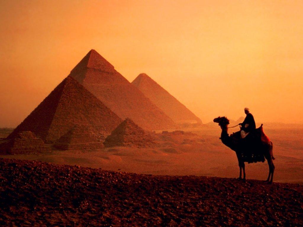
The continent is bordered by the Arctic Ocean (North), the Atlantic Ocean (East) and by the Pacific Ocean on the West. The two oceans are connected under the narrow Southern part of the continent. Due to the fact that they lie extremely close to each other at Central America, the Panama Canal was built at the narrowest part of the isthmus.

East from Central America, the archipelago of the Caribbean Sea is located with the Lesser Antilles, the Greater Antilles and the Bahamas.

Because of the numerous peninsulas, islands and gulfs the coastline is said to be indented.

Greenland, the greatest island of the world, belongs to the islands of the Arctic Ocean. The islands of the Eastern part: Florida and the Labrador Peninsula. On the West, we can find Alaska and California which run out far into the sea.

The two largest gulfs are the Hudson Bay and the Gulf of Mexico.

The coastline of South America is unindented.

America is the second largest continent after Asia in size: 42.1 million km2.

The relief of land and the mineral resources of North America

The oldest part of it is the Canadian Shield which embraces the Hudson Bay. Towards the West and South-west the shield can also be found under the sediments of the neighbouring regions. It is actually built up of granite and has been created by destruction which consumed many hundred millions of years. That is why its minerals are close to the surface now. Its current surface got created thanks to the Ice age. The ice cap planed its surface by its sliding motion. The soft rocks were excavated, the harder ones were smoothed and the debris was deposited. After the continuous melting of the ice cap the continent started to elevate. The basins were filled up by lakes and the rivers also contributed to the further creation of the relief of North America.

The Appalachians, which lie on the Eastern side of the continent, elevated in the Paleozoic. Between the ranges of the block mountains, there are fertile plateaux and river valleys. On the terraced slopes rivers flow with several waterfalls. Their powers are utilized by hydroelectric power plants. The most important mineral resource is the black coal.

The youngest and the highest mountains of the continent are the Cordilleras and they got created in the tertiary period as a part of the Pacific mountain system. The orogenesis still hasn’t come to and end due to the closing Pacific plate and North American plate. An obvious proof of this was the eruption of Mount St. Helens in 1980.

The ridges of the Pacific mountain system can also be found in South America and even in Asia on the coasts of the Pacific Ocean.

The Western ridges of the Cordilleras are young mountains that are separated by trenches.

The innermost arch of the Cordilleras are the Rocky Mountains which blocks have been arised by Pacific movements again. Its ice-capped peaks make the mountain similar to mountain chains.

The ranges of the Cordilleras embrace several plateaux, such as the Colombian Plateau, the Colorado Plateau and the Mexican plateau.

On the area of Central America the ranges continue with frequent earthquakes and volcanic eruptions.

On the slopes of The Rockies can be located the tables of the Preri which is covered by loess.

The lowest and youngest region of North America is the Mississippi Plain. Once it was flooded by the ocean. Its horizontally deposited layers of sediments hide oil and natural gas. On the thick layers the Mississippi and its tributaries deposited debris.

The relief of land and the mineral resources of North America

South America has two shields: The Guyana shield and the Brazil Highland. Both were parts of the Gondvanaland on the Southern hemisphere. Their pieces, which are connected deeply under the land, are actually connected by the Amazonas Basin on the surface which is mainly built up of the sediments of the sea and deposits.

The ridges of the Western part of the continent elevated because of the folding of the oceanic and the continental plate. The deposits of the oceanic plate and the rocks of the plate themselves went deep and melted, and intensive volcanic activity started: this is how the volcanic ridges were formed. The folded sediments elevated on the Eastern part.

The Andes, which are the longest mountain chains all over the world, formed in this way as part of the Pacific mountain system. In front of it, under the Pacific Ocean, there is a trench because it is a subduction zone where the oceanic plate goes under the continental plate.

This process, which started in the Mesozoic, has not yet come to an end. Because of the colliding plates, volcanic activities and earthquakes are still very frequent. The Southern part of the Andes is the second in the row of the most seizmic parts of the Earth after Japan.

The Andes have many magmatic rocks – such as the andesite which name is similar to the name of the mountain itself.

Over and above the factors mentioned above – because of the height above sea level -, the surface was formed by the ice as well.

The ranges are North-Southern in orientation. They surround plateaus. The greatest one of them is the Bolivian Plateau which is covered by a thick layer of debris and lava.

The mineral resources of the Andes got close to the surface during volcanic activities and they are ores of non-ferrous metals and precious metals such as copper, tin-stone and silver.

The youngest regions of the continent are the plains. The plain of the Northern part of South America is the Orinoco Basin which is rich in oil. The Parana Plain is located on the Southern part of the continent. In the basin of the Amazon River not only the largest plain of the continent but that of the Earth is lying as well. In the Tertiary period there was a gulf but the accumulation of the debris of the Amazon River created a plain on the area of it. Its slope faces the Atlantic Ocean.

Last but not least, we have to mention Patagonia which is built up of tables and on which the accumulated volcanic debris and the debris of the glaciers are originated from the Andes.

Climate of Hungary

Location:
-absolute location:-northern hemisphere:
-eastern hemisphere:
-relative location:-Eastern Central Europe

Hungary is located in the-temperate zone
-true temperate belt
-moderately continental region
-wet continental climate

Wet continental climate /ordinary data/:
-there are 4 seasons: cold winter, spring, warm summer, autumn
-annual mean temperature:
-annual mean temperature fluctuation:
-annual mean precipitation: 500-800 mm
-vegetation: oak forest
-soil: brown forest soil
-droughts are frequent in July and August


Hungarian climate is influenced by:
-distance from the ocean
-basin characteristic
- the cyclones and anticyclones, which are formed above:
1. -the Atlantic Ocean
2. -Eastern Europe
3. -the Mediterranean Sea


Duration of sunshine: - South Duna-Tisza köze: 2100 hours/year
-near the western border: 1700-1800 h/y

Temperature:-annual mean temperature:
-annual mean temperature fluctuation:
-the highest temperature is on the South-East part of the country

Wind:
-on the western side of the Tisza and on Transdanubia : north-western winds
-on the eastern side of the Tisza: north-eastern winds
-Danube-Tisza Interflow: north winds
- Northern Mountains: chaotic winds

Precipitation: -annual mean precipitation: 500-900 mm
-the difference among the monthly mean precipitations can be extremely large
-most of the precipitation fell-in the end of the spring
-in the beginning of the summer
 
Copyright © 2007- Érettségi vizsga tételek gyűjteménye. Designed by OddThemes | Distributed By Gooyaabi Templates