Friss tételek
A következő címkéjű bejegyzések mutatása: angol. Összes bejegyzés megjelenítése

Natural geographic characterization of the Great Plain

-Whole Territory of it is 100,000 And 52,000 are in Hungary.

- This scenery is the most extended in Hungary.

-The most uniform in a way of relief and climate.

-Large part of it is perfect plain. perfect plain: where the distance between the lowest and the highest point is smaller than 100 m.
-Landscape of it was transformed by people. - deforestation /from the early Middle Ages/
-control of the Tisza and its tributaries/ 19th century / (mellékfolyók)
-So the characteristic Hungarian landscape, the “puszta” is not a natural landscape of the territory, but it was formed by human.


Parts of the Great Plain:
4.-Beregi-Plain 1. loess (hordalékkúp)
-Beregi-Tiszahát (löszös hordalékkúp)
-Szatmári-Tiszahát 2. sandy (hodalékkúp)
4.-Szatmári-Plain 3. drained marsh ->
3.-Ecsedi-moor (láp) ->meadow, pasture
2.-Nyírség 4. flood-basin (ártér)
-Hajdúság
4.-Bodrog-köz
-Rét-köz
4.-Takta-köz
-Hortobágy
-Nagykunság
3.-Nagy-Sárrét
3.-Kis-Sárrét
1.-Jászság
-Tiszazug
1.-Maros-Kőrös köze
2.-Kis-Kunság
1.-Solti-Plain
1.-Pesti-Plain
-Mezőföld
1.-Sárköz
-Drávamellék

National Parks of the Great Plain:-Hortobágyi
-Kiskunsági
-Körös-Maros
-Duna-Dráva

Characterization of some parts of the Great Plain:
We can divide the Great Plain into two parts on the basis of the catchment areas :(vízgyűjtő terület)
-Dunai Great Plain
-Tiszai Great Plain

Dunai Great Plain

Dunamenti-Plain:-it is near the Danube for 15-30 km
-Pesti-Plain: free of flood (ármentes)
-southern part extended flood-basin
-on the south, on the right side of the river is the Sárköz

Kiskunság:-it formed in the Pleistocene
-130-170 m high alluvial cone
-sandy soil
-there are dunes still in movement /Bugac, Fülöpháza/


Mezőföld: -covered by loess
-on the right-hand side of the Danube
-many landslides /Dunaújváros, Dunaföldvár/


Drávamellék:-on both side of the river
-only the left-hand part is in Hungary
-mediterranean climate
-the most precipitation of the Great Plain /700 mm/year /

Tiszai Great Plain

Tiszamente: 
-artificial ox-bow lakes are frequent
-15-25 km wide

Jászság:-near the lower course (alsó folyás) of the Zagyva

Nyírség: 
-covered by sand
-there is the highest point of the Great Plain: Hoportyó-183 m

Hajdúság:
-covered by loess


Hortobágy:
-important touristic centre
-it is a part of the World Heritage

Nagykunság:
-the driest part of the country /less than 500 mm/year/
 
Körös region:
-perfect plain
-there were marshes

-now: meadows, pastures

Maros-Körös köze:
-covered by loess

-its south eastern part is the hottest part of the country /annual mean temperature is 11°C, mean temperature in July is 22°C/

The History of the Earth (mainly that of the Mesozoic Era)

Paleonthology: 
- the study of the history of the Earth
- uses the fossils (=remains of plants or animals from pre-historic times. They are found in
sedimentary rocks.) to establish the age of the rock layers
2 dating methods:
1.) relative dating method:  based on the law of superposition (=youngest rock layers are ont he top of the rock sequence whereas the oldest are on the bottom.) a this method is rarely because both of internal forces (folding, faulting) often rearrange the layers!!

2.) absolute dating method:  based ont he natural radioactivity of certain minerals (uranium,
thorium)
- C14 is used to determine the age of the organic matter

On the basis of the dating methods geologists have established a geological timescale which has got eras, periods and epochs:
ERAS
PERIODS
Cenozoic
(65 million years)
Quaternary 
--- holocene (present time)
--- pleistocene (ice age)

Tertiary 
--- pliocene
--- miocene
--- oligocene
--- eocene

Mesozoic
(235 – 65 million years)
Cretaceous
Jurassic
Triassic

Paleozoic
(590 – 235 million years)
Permian
Carboniferous
Devonian
Silurian
Ordovician
Cambrian

Proterozoic
(2600 million years)
---------
Archaeozoic
(4600 million years)
----------


ERAS:
Archaeozoic (ősidő):
-volcanic activity a gases a forming a palaeoatmosphere
-gradual cooling a water condensed a paleo-ocean
-continental crust formed
-rich in CO2, ammonia, nitrogen-oxide

Proterozoic (előidő):
- mountain formation a erosion a ancient shields
- ancient life forms (bacteria, algae)

Paleozoic: - photosyntesis a ozone layer
- first land plants appeared
- Caledonian and Variscian mountain systems started to form
- formation of Gondwanaland
- all the continental cores connected a supercontinent (Pangaea) formed
- Panthalassa (+ Tethys /gulf of Panthalassa)
- formation of coal

Mesozoic:
- Triassic: Pangaea divided into Laurasia and Gondwana
- Tethys substituted Panthalassa


Laurasia slided to the North
Gondwana slided to the South
- Jurassic:- formation of a rift valley led to the formation of the Atlantic Ocean
that separated Eurasia from North-America and Africa from
South-America
-convergent plates a volcanic activity a Pacific
mountain system started to form
- Australia was still connected to Antarctica
- Cretaceous: - the world ocean reached its largest extention
- Eurasia separated from North-America, and Africa from
South-America
- Eurasian mountain system started to form

Fauna&flora:
Triassic: dinosaurs, first mammals appeared
Jurassic: - the main era of reptiles
- spread of ammonites (mészvázúak)
- first flowering plants
Cretaceous: by the end of the era they extincted aprobably a huge meteor impact
caused it due to which the level
of oxygen decreased on the Earth
(the depression of this caused by
this meteor still can be observed
on the Yukatan Peninsula)

- most characteristic plants are angiosperms(zárvatermők) and gymnosperms(nyitvatermők) (EZ NEM FONTOS!!!)
Cenozoic: - present location of the continents
- spread of mammals and birds
- formation of mineral oil and natural gas
- volcanism
- the end of the formation of the Eurasian and Pacific mountain system
- Atlantic and Indian Ocean formed
- climate got colder a Ice Age
- the end of the era (holocene): climate got warmer and the land was shaped by external forces + the appearance of the Homo Sapiens

(A MESOZOIC A LEGFONTOSABB, A TÖBBIRŐL CSAK A LEGLÉNYEGESEBBEKET KELL TUDNI!!!)

Japan

Nowadays Japan is one of the countries which produces the most rapid economic development. In the last decades of the twentieth century, we can talk about a kind of explosion in the case of Japan and the little tigers. Although Japan has been isolated for several centuries and belonged to the losers of the Second World War, it has undergone a rapid development thanks to the contribution of the USA.  

It has several causes:
- Japan invested a lot of money into huge projects and spent little money on military purposes;
- Relying on the scientific breakthroughs Japan introduced the most up-to-date machinery products and production methods;
- disciplined and cheap Japanese labour force
- exemplary cooperation amongst the industrial branches and their workers;
- The cheap and high quality products initially conquered the South Asian region and later the whole world market and Japan supplelyrugalmasan accommodated itself to the foreign demands.
- A very efficient educational system was formed in order to ensure the economic development.

Japan is poor in mineral resources. This is why it is the greatest importer of raw materials and energy resources in the world. The needed coal, iron ore and uranium ore is imported by its own fleet. Primarily from those countries where there opened mines with Japanese financial support. Japan imports mineral oil from the Middle East and it is processed in oil refineries and chemical industries that are installed on the coasts. The Indian iron ore, the Malaysian and Philippine non-ferrous metals and the Australian bauxite are also processed by them. The production of crude iron and steel is on the forefront in the world.The most important branch of processing industry is machine production. Within precision engineering the machine-tool industry and vehicle-making are the most important. In tanker and car making Japan is the number one in the world. And in the production of electronic and informatic tools as well. Japan installed those factories to South Korea and Hong-kong where less up-to-date products are made. For those industrial branches where planes, missiles, satellites and industrial robots are formed, separated technopolises are formed. The cities not only ensure work for their dwellers but healthy and nice environment as well. There is a Silicon valley (like in the USA) which is a technology park.

Japan organizes its transportation via eight great and one thousand smaller ports. The greatest ports are in Osaka. The merchant fleet is the third greatest in the world. The rail transport is very precise and quick in the country.

The temperate zone

There are 4 seasons in the entire temperate zone, it is because the Earth orbits around the Sun and its axis is inclined and the inclination does not change during one rotation.

The westerly winds are the prevailing winds in the whole zone.

Warm temperate zone

On the western side of the mainland a mediterranean climate, on the eastern side a subtropical monsoon climate has developed in the warm temperate belt.

The mediterranean area is the largest in size in the region of the Mediterranean Sea.
Two seasons:
Summer: hot and dry
Winter: mild and rainy.
Annual mean precipitation: 400-1000 mm; annual mean temperature fluctuation: 15-20°c; annual mean temperature: 10-20°c.
Winds: in summer, the descending branch of the trade winds; in winter,
The large forests have unfortunately been partially eliminated.
Vegetation: citruses, dates, grapes, figs, bay trees, Lebanon cedar trees, evergreen shrubs.
The red terra rossa is the most characteristic soil. It’s poor in humus because there is little humus formation. In the deciduous forests: cinnamon-coloured forest soil.
The water levels are extremely fluctuating because of the characteristics of the climate: in summer, the river beds may dry up but in the winter there are heavy floods.
The surface is chiefly shaped by the rivers.

The subtropical monsoon regions lie on the eastern side of the mainland.
2 seasons:
Winter: cool and dry
Summer: hot and rainy.
Annual mean precipitation: 1000-1500 mm; annual mean temperature fluctuation: 5-25°c; annual mean temperature: 10-20°c.
Winds: the alteration of summer and winter monsoon winds.
Vegetation: Bay foliage forests, bamboo, tea shrubs, rice (even 2 harvests a year), cotton.
The soils are red and yellow and are poor as they contain little humus.
The main surface forming forces: In winter: disintegration and surface washing; in summer: deepening river erosion.

Cold temperate zone

It has developed only in the northern hemisphere.
2 seasons:
Winter: very cold and long
Summer: short, relatively warm and rainy.
Annual mean temperature: 0 - -10°c; annual mean temperature fluctuation: 20-70°c; annual mean precipitation: 200-700 mm.
Winds: westerly winds and sometimes polar winds.
Vegetation: taiga. The largest pine forests.
Not so fertile podzol soils have been formed in the whole zone.
Down to the great fluctuation of temperature, disintegration is significant.
Forestry and the breeding of fur animals are significant.


True temperate belt

Between the cold and warm temperate zones.
The climate is determined by the westerly winds and the cyclones. Less and less precipitation towards the interior parts of the continents. Four regions: oceanic, moderately continental, continental and extremely continental.

The oceanic regions have developed by the coasts.
Two seasons:
Summers are cool.
Winters are mild.
Annual mean temperature: 5-12°c; annual mean temperature fluctuation:7-15°c; annual mean precipitation: 800-2000 mm.
The annual distribution of precipitation is even.
The large beech forests have largely been eliminated. The grass is green throughout the year.
Soil: brown forest soil and podzol in the cooler northern areas.
The disintegration of rocks is governed by weathering. River erosion is the main surface forming force.

The moderately continental regions lie East of oceanic regions and on the eastern coasts of the continents. Weaker and weaker oceanic features.

Winters are cold and summers are warm. Four „regular” seasons.
Annual mean temperature: 0-12°c; annual mean temperature fluctuation: 10-20°c; annual mean precipitation: 500-800 mm.
Droughts are frequent in warmer southern areas in July and August. On the eastern side of the continent, the summer monsoon brings abundant rainfall.
Vegetation: oak forests. Beech forests (400-1200 m). Towards the interior of the mainlands, wooded prairies occupy the place of deciduous forests.
Brown forest soil is the predominant soil type.
Surface forming forces: disintegration, weathering and watercourses.

Continental regions

Cold winters and warm summers. The early summer is the most rainy.
Annual mean temperature: 0-15°c; annual mean temperature fluctuation: 25-45°c; annual mean precipitation: 300-500 mm.
Westerly winds.
Vegetation: grassland. In Eurasia: steppe; in North America: prairie; in South America: pampa.
The steppe soil in the tall grass region contains much humus. Chestnut-brown soil with dwarf grasses.
Disintegration, weathering.
Vegetation: arable land; potato, wheat,
Cattle and sheep breeding.

Extremely continental regions

Cold winters and hot summers.
Annual mean temperature: 0-15°c; annual mean temperature fluctuation: 25-50°c; annual mean precipitation: 100-200 mm.
Westerly winds.
Semi-deserts and deserts. E.g. the Gobi. Located in the interior of the continents or in the vicinity of the oceans in basins surrounded by high mountains.
Nomadic shepherding, oases.

Transformation of the structure of industry on the basis of the old industrial regions of the EU

Industry: a branch of economy The process in which industry becomes the leading branch of economy, is called industrialization.

Most important industrial regions of Europe a developed in the 18th-19th cent. at the time of the exploitation of coal deposits Where coking coal and iron ore appeared a rapid industrialization began

Largest industrial regions are installed at the old mining areas:
e.g.:
- Black Country
- Meuse Valley (Belgium)
- vicinity of Lille
- Lorraine
- Asturias
- vicinity of Bilbao
- Ruhr & Saar region

Ruhr region as an example of all
- characteristic polycentric urban agglomeration
- hard-coal-based
- 4/5 of the coal mined in Germany
- 1 of crude oil and steel production comes from here
- Nearly 1 of Germany’s chemical production
- exhausted iron mines (Rhine schist mountains) assisted the expansion
- navigable canals of the Rhine of the ind. district
- Rhine and its tributaries are not enough to supply the water demand of the region a industrial water is re-used (water recycling)
- most important ind. branches are in connection with coal mining
- coke (koksz) is a dominant factor in the location of metallurgy
- they import Swedish, African and Brazilian ores
- power plants (erőművek) which are fed by hard coal provide electric power
- heavy industry: - great consumer of rolled steel plates
- manufacturing of mining machines
- metallurgical and power plant machinery
- railroad
- military equipment
- chamber gas is used for making chemical products and glass works
- old plants were converted in oil refineries
- petrochemical industry settled here a gets raw-material through pipelines
a pushes coal chemistry into the background
- textile factories a employing female labour force
a processes mainly the synthetic fibres (műszál) produced nearby
Structural crisis of the last 3 decades:
1.) since the 1950’s aamount of coal mined decreased to 1
a the amount of employees decreased to 1/3
2.) increased use of artificial materials and special metal alloys a demand for steel
decreased worldwide
3.) up-to-date technical procedures appeared
blast furnaces: - located near iron ore mines
- combines which obtained inexpensive raw-materials from
overseas a advantageous situation
- operate right near the Rhine ports (e.g. Duisburg)
- operate in cities lying farther from the waterway
(e.g. Dortmund)

Coal & steel crisis a many jobs disappeared in a short time

migration
Ruhr region had to attract new, up-to-date branches of industry
by offering various advantages (e.g. Opel Works settled here)

expansion of chemical industry and electrotechnics

cities became more attracting

But crisis is still not solved, outmigration and unemployment still exist.

Economic stagnation in other areas as well:
e.g. traditional textile industry regions

around Lille and Lyon
in the vicinity of Liverpool and Manchester

more and more companies cannot withstand the competition (with the cheaply produced goods in developing countries)

have to be closed

unemployment decline of
outmigration the European
gradual transformation of the structure of industry textile centres

Transnational companies

Definiton: Those companies the activity of which pass the borders of their country, thus they do not produce their products in only one certain country, but in the whole world economy. They establish subsidiaries or contain companies in different countries. Sometimes they are called multinational companies („multi”), but a company is actually called „multi” if its owners are from different countries.

Summary: - passes the borders of its country
- produces in the whole world economy
- sells its products at the world market
- establishes subsidiaries
- is called „multi” sometimes

Aim: They locate certain activities to certain countries or regions in order to decrease the budget of production to the minimum and increase the profit to the maximum.

Reason for their establishment: the world economy became worldwide in the 1970’s oil crisis of the 70’s a companies had to recognize the demand of the consumers a they have to take the appropriate product to the market fast competition have to be able to produce the goods on the lowest price they locate the factories to different places where the certain part of production is the cheapest

Consumers’ demand: goods produced in relatively short series, and those change fast a need of fast reaction a flexible (rugalmas) production

Large-scale development of communication a condition of the worldwide location of production
a possibility for the transport of capital in a short time

General Characterization:
1.) After the World War II: - companies had subsidiaries abroad
parent company subsidiary
decision production
research & technology
2.) Nowadays: transnational companies + their subsidiaries = integrated network of
production
parent company subsidiary
headquarters of the company production
decisions are made here
control of planning
control of research and development
control of market research


Operation system of the TNCs
market research & marketing
close to the consumers’ market
research & development
close to the large cities containing universities
production
all over the world
production of basic materials
in developing countries, close to the raw- material and energy („kéményes ipar”)
production of components (részegységek)
anywhere where there is cheap, but skilled labour force and tax allowance (adókedvezmény)
production of the end product (végtermék) + assembly (összeszerelés) + marketing (értékesítés)
near the consumers’ market

The basic condition for this system is the modern infrastructure. The activity of the TNCs is followed by the flow of functioning capital a strengthens the role of financial sector

Competition between TNCs a they spend much on Research + Development
a they always change their park/site (telephely) according to
the beneficial possibilities of world economy
a dispersion (szétszórtság) is characteristic
creates possibility for work
As the role of national economies role of TNCs grow
decreases

Transport of Hungary

A good transport system and a fast and cheap transportation help the economical production.

 Hungary is the meeting area of the west- east end the north-south transport system of the Carpathian-basin. So the transit traffic (átmenő forgalom) is considerable.

The Hungarian transport system needs development. So they build new-motorways 
-railways
-airports
-ports  
-navigable canals (hajózható csatorna)
Transit (áruszállítás): 
I. truck (tehergépkocsi) transport
–it need not transhipment (átrakodás)
-relatively cheap
II. railway
- it is appropriate for transport of mass goods (tömegtermékek)

People transport (személyszállítás): 
I. coach-between cities and villages bus-between homes and workplaces
II. air transport-for long distances

Hungarian transport is radial built (sugaras szerkezetű) and it is extremely (túlzottan) Budapest centred.
Density of the transport system is medium compared to (viszonyítani v-mihez) the European average.
Settlements without railway are connected to the transport by coaches.

Railway:
-The name of the Hungarian railway is Hungarian National Railway: MÁV
-There are large differences between the circulation of the certain lines.->some of them are
-It has good joints to the European railway system. given up for today
-It can develop, if it can take place in a larger degree in the combined carriage.
-Railway is faster and cheaper than the truck transport. (kombinált fuvarozás)
-The busiest railway stations: 
-Budapest
-Hatvan
-Miskolc
-Debrecen
-Székesfehérvár
-Győr

Road-system:
-Roads are not strong and wide enough for the extended traffic.
-Roads, which are internationally significant, are very crowded (zsúfolt).
-Highways and main roads are side by side the railways.->There are no opportunities to make new economical relations inside the country.

Highways: 
-M0:Bp. beltway
-M1:Bp.-Tatabánya-Győr-Hegyeshalom
-M2:Bp.-Vác
-M3:Bp.-Miskolc, Debrecen
-M5:Bp.-Kecskemét-Szeged
-M6:Bp.-Dunaújváros
-M7:Bp.-Székesfehérvár-Zamárdi-Rédics

Main roads: 
-Mr2:Bp.-Vác-Hont
-Mr3: Bp.-Miskolc-Tornyosnémeti
-Mr.4:Bp.-Debrecen-Nyíregyháza-Záhony
-Mr.6:Bp.-Pécs
-Mr.8:Székesfehérvár-Szentgotthárd

Navigation (vízi közlekedés):
-Navigation  is only significant in external trade.-Rhine-Main-Danube canal
-The cheapest kind of transport, but it is slow.
-Significant traffic is only on the Danube.
-It has natural disadvantages:
 -autumnal and wintry low tide (vízállás)
-frost
-ice drift (jégzajlás)

Reasons, why lost the watery transport its significance:
-Ships on the Danube are antiquated and there is no money for the development.
-The Danube and the Tisza flow side by side and there is no connection between them.

Air transport:
-This kind of transport develops the fastest.
-The fastest kind of transport, but it is expensive.
-It is economical only in the international transport.
-The name of the Hungarian airline is MALÉV.
-The busiest international airport is Budapest-Ferihegy.
-Other airports are for example in Debrecen and in Sármellék.

The liquid and gaseous goods, such as mineral oil and natural gas, are transported by pipelines (csővezetékek).

Underground waters in Hungary

The greatest storages of layer waters (rétegvizek) are the alluvial cones that formed in the quaternary period. If the water of the rivers infiltrates through the sand and marble layers, it is called water filtered at the bank (parti szűrésű víz). For instance, the water demand of the inhabitants of Budapest is satisfied from this water stock (vízkészlet).

A group of layer waters: artesian waters (artézi vizek). These waters come to the surface because of the high pressure.

By the 19-20th century the demands have been satisfied from the waters of the wells, these are called ground waters (talajvíz, remélem ez a jó szó rá). This was a serious source of infection, no doubt. 5-10% of the extracted water is still ground water.
If the water table (the surface of the ground water, talajvíztükör) elevates above the ground, then it is called inland water (belvíz).

Another group of layer waters: thermal waters (hévíz). If the temperature reaches 30°c.

At karstic areas where water infiltrates through the surface, the space waters (résvizek) appear in the form of cold or warm karstic springs. They have had an important role in the drinking water supply of Miskolc and Pécs for a long time. However, they are still present at the spas of Hévíz, Eger and Buda.

Unequal economic development within the European Union

Within the European Union, The so-called Blue Banana is the most developed district. Its extension: Southern part of England – Benelux states – Ruhr Region – the valley of River Rhine – Switzerland – Northern Italy.

Germany
-          The most developed economy and industry
-          44% of the workers are employed in the industry
-          Outstanding: machine industry, factory equipment, vehicles and electronic goods
-          Thyssen: the biggest metallurgical corporation
-          Car-making: Volkswagen, Mercedes
-          Chemical industry: Bayer, BASF
-          1990: unified Germany, the equalization between the two parts took up several years

France
-          Varied natural resources & well-balanced economic structure
-          Industry: in the surroundings of Paris and in the North
-          Other development centres: Marseille, Toulouse, Bordeaux

Great Britain
-          After the loss of her colonies England has fallen behind her European competitors
After this:
-          Rapid development in Southern England
-          The old industrial districts of Central England suffer from the crises of coal mining, metallurgy and textile industry even today
-          Less developed: The North (Scotland), oil production and microelectronics

The Benelux countries and Denmark
-          Overdeveloped metropolises: Copenhagen (Denmark), Amsterdam, Rotterdam (the Netherlands) and Brussels (Belgium)
-          In Belgium, the Fertile Flemish part by the seacoast was outstanding for decades

Ireland
-          The least-developed country of Western Europe
-          In recent decades, tax allowances were granted for foreigners in order to facilitate industrialization

The less developed peripheral part of the EC is the Mediterranean area.
-          The Industry of Spain, Portugal and Greece expanded rapidly in the last few decades
-          Favourable natural conditions: they are the main suppliers of early vegetables, citruses, wine and edible oils on the European market
-          TOURISM. Spain and Italy are the 2 most important countries

Italy
-          The Northern part is more developed than the Southern one, it has historical roots
-          In the North: Turin-Milan-Genoa triangle
-          Po Valley: very fertile plain

The newly-joined countries mainly belong to the pheripheral countries of the European Union, except for some developed districts. These countries cannot catch up with the developed central parts and not just because of their physical position but their size and previous development are also not the class of the field.

World Trade in the 20th century

1st half of the 20th cent.:
- free competition a countries got into overproduction crisis a a
lot of companies went bankrupt a they were bought a companies concentrated in a few hands a monopole capitalism
- on the colonies labour force was cheaper a they took their capital there a it is called colonial capital export.
- Germany, Japan, and the USA connected into the international share of work a the autarchy (egyeduralom) of Great Britain ceased a multipoled (többpólusú) world economy formed
- I World War: USA and Japan strengthened The economical crisis of the world (1929-33) tumbled (szétzilál) world trade.

After the II World War:
- 3 types of countries formed: socialist, capitalist and developing
Countries
- there were national economies those were separated by tariff borders and they limited the free flow of goods and capital a world market was a totality of national economies, world trade passed off (lezajlik) between the countries
- capital export increased

Nowadays: - world trade passes off mainly between the countries of the centres of world economy, especially between the 3 centre poles of growing (Triad)


Triad:
- the main flow of capital, technology and goods happens between its countries
- Its countries possess the 80% of the world’s all operating capital

Japan:
- 7% of goods of the world market comes from Japan
- one of the most important functioning capital exporters (exceeds its func. capital. import)
- most important goods that Japan imports is raw-material
- has the most significant commercial activity and commercial surplus related to the other countries of the Triad

European Union:
- The EU supports commerce in her own territories a creams off The goods brought from outside the borders- In the EU there are so-called world cities (and almost everywhere int he world) which have certain tasks (e.g. Frankfurt and Zürich are financial centres). World cities are the centres of worldwide flow of information and capital.
- the commercial activity of the EU produces only a little surplus
- participates by 1/3 of the functioning capital import and export of the world

The USA:
- main stronghold of its economy are commerce and financial activities
- its main partner in functioning capital export is the EU
- it accumulates the most commercial deficit related to all countries of the Triad
- its functioning capital import and export is the largest in the world

The Little Tigers, which are the newly industrialized countries of East-Asia, and their second generation are also important participants of world trade.

- first generation: S-Korea, Taiwan, Singapore, Hongkong
- second generation: Indonesia, Malaysia, The Philippines, Thailand
Singapore is the most important commercial junction (csomópont) of the Little Tigers.

International capital flow:
1.) End of the 18th.cent. – I World War: colonial capital export
Capital export of th developed countries was directed towards the colonies rich in raw-materials and towards East- Central-Europe

2.) Between the two world wars: capital flow fluctuated
3.) After the II World War: capital movement between developed countries was characteristic (mainly between the EEC and the USA)
- main aim of the capital flow was the substitution of foreign trade (külkereskedelem).

4.) 1970-85: 
-Japan joined the investors but took part only in functioning capital export
- USA and EEC took part in both capital import and export

Capital export from developed to developing countries appeared again
Aim: located the old technologies to the developing, but industrializing
Countries a it is called production outplacing export (termeléskihelyező export)

4.) Nowadays:
- main functioning capital exporters are: Great B., Germany, USA, Japan (countries of the economical poles)
- 80% of all funct. Cap. Flow happens among them
- new phenomena: Japan exports its functioning capital into developed countries a J. can appear more easily on their market
- funct. capital flow still substitutes the foreign trade
- funct. cap. Flowing towards the countries of the peripheria (East-Central Europe, China, Vietnam)
serves the interests of the transnational companies
- colonial investments are outworn
- almost half of the funct. cap.flows into services

Environmental art

The term Environmental Art is used in two different senses.

The term can be used generally to refer to art dealing with ecological issues and/or the natural, such as the formal, the political, the historical, or the social context.
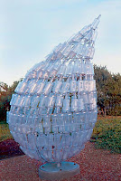
Environmental artIt is possible to trace the growth of environmental art as a 'movement', beginning in the late 1960s or the 1970s. In its early phases it was most associated with sculpture — especially Site-specific art, Land art and Arte povera — having arisen out of mounting criticism of traditional sculptural forms and practices which were increasingly seen as outmoded and potentially out of harmony with the natural environment. The category now encompasses many media.

Recently Sustainable art has emerged as an alternative term to environmental or green art, in recognition of the challenges that sustainability brings for contemporary art as a whole.

Environmentalism into Art


Environmental artIn identifying Environmental art a crucial distinction lies between environmental artists who do not consider the damage to the environment their artwork may incur, and those who intend to cause no harm to nature. Indeed, their work might involve restoring the immediate landscape to a natural state. For example, despite its aesthetic merits, the American artist Robert Smithson’s celebrated sculpture Spiral Jetty (1969) involved inflicting considerable permanent damage upon the landscape he worked with. Smithson using a bulldozer to scrape and cut the land, impinging upon the lake. This Environmental Art also raised awareness of the importance in recycling materials.

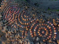
Environmental artAlan Sonfist, with his first historical Time Landscape sculpture, proposed to New York City in 1965, visible to this day at the corner of Houston and LaGuardia in New York City’s Greenwich Village, introduced the key environmentalist idea of bringing nature back into the urban environment. Today Sonfist is joining forces with the broad enthusiasm for environmental and green issues among public authorities and private citizens to propose a network of such sites across the metropolitan area, which will raise consciousness of the key role that nature will play in the challenges of the 21st century.The sacredness of nature and the natural environment is often evident in the work of Environmental Artists. Chris Drury instituted a work entitled "Medicine Wheel" which was the fruit and result of a daily meditative walk, once a day, for a calendar year. The deliverable of this work was a mandala of mosaiced found objects: nature art as process art.

Environmental artIndeed, such criticism was raised against the European sculptor Christo when he temporarily wrapped the coastline at Little Bay, south of Sydney, Australia, in 1969. Local conservationists staged a protest, arguing that the work was ecologically irresponsible and adversely affecting the local environment, especially the birds that nested in the wrapped cliffs. Complaints were only heightened when several penguins and a seal became trapped under the fabric and had to be cut out. Conservationists' comments attracted international attention in environmental circles, and lead contemporary artists in the region to re-think the inclinations of Land art and Site-specific art.

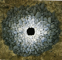
Environmental artIn comparison, a committed Environmental artist such as the British sculptor Richard Long has for several decades made temporary outdoor sculptural work by rearranging natural materials found on the site, such as rocks, mud and branches, and which will therefore have no lingering detrimental affect. Crop artist Stan Herd  shows similar connection with and respect for the land. While leading Environmental artists such as the Dutch sculptor Herman de Vries, the Australian sculptor John Davis and the British sculptor Andy Goldsworthy similarly leave the landscape they have worked with unharmed, and in some cases have in the process of making their work revegetated with appropriate indigenous flora land that had been damaged by human use. In this way the work of art arises out of a sensitivity towards habitat.

Environmental artPerhaps the most celebrated instance of Environmental art in the late 20th century was 7000 Oaks, an ecological action staged at Documenta during 1982 by Joseph Beuys, in which the artist and his assistants highlighted the condition of the local environment by planting 7000 oak trees throughout and around the city of Kassel. In the last two decades significant environmentally-concerned work has also been made by Rosalie Gascoigne, who fashioned her serene sculptures from rubbish and junk she found discarded in rural areas, Patrice Stellest, who created big installations with junk, but also pertinent items collected around the world and solar energy mechanisms, and John Wolseley, who hikes through remote regions, gathering visual and scientific data, then incorporates visual and other information into complex wall-scale works on paper. Environmental art or Green art by Washington, DC based glass sculptor Erwin Timmers incorporates some of the least recycled building materials; window glass.
[edit] Renewable energy sculpture

Renewable energy sculpture is another recent development in environmental art. Representing a response to the increasing urgency in the global climate change debates. Generally the practice is evolving in public sculpture and to an extent in experimental architecture. The response is make an explicit intervention at a functional level, merging aesthetical responses with the functional properties of energy generation or saving. Practitioners of this emerging area work to ecologically informed ethical and practical codes that conform to Ecodesign criteria.

My Daily Routine

My Daily RoutineIt seems my life is always very full of activities and obligations so I never have much time for myself. During the week it's the worst. I usually have to get up at half past six even though I would really prefer to sleep much later. After I get up I perform my morning routine of washing my face, brushing my teeth, and then deciding what to wear. After I get dressed I brush my hair. I usually don’t have time for breakfast in the morning because I have to catch a bus at seven o'clock for my commute to school. The bus is usually completely packed and it really makes me envy my schoolmates who don't have to ride the bus to school. Classes at school start at a quarter to eight except on Tuesdays when they start at seven. Each class has its own timetable so my schedule varies by class. Classes are forty-five minutes long with ten minute breaks, except for one "long" break between the third and the fourth classes, which is twenty minutes long. 

My classes take place either in our classroom or in various labs or a gym. After our classes the students usually go for lunch to the canteen. Some students in their third and forth year have afternoon classes, seminars, optional after-school activities or driving lessons. 

My Daily RoutineAfter school I sometimes go shopping or just walk around the town for a while. When I get home I like to relax for some time, I listen to the radio, watch television, and maybe get a little snack. Then I start my homework or help with some housework. Before I know it, the afternoon is gone and it is evening. 

In my family, we usually eat dinner at about seven o'clock. At dinner we discuss what happened during the day and catch up with each others' lives. After I help clean up the dinner dishes I either take a shower or have a bath myself. Then I have some time to watch the TV news. Sometimes I watch an interesting film or music program on TV or a video. Sometimes I like to go downtown to see a movie or to go to a concert with my friends. About every other day a I have a date with my boyfriend. Sometimes he comes to watch TV at my home or we might go out for a walk. I usually manage to go to bed around eleven PM. 

So this is my daily routine during the week. On the weekend ("at the weekend" v britské angličtině) it is a different story, I like to sleep late and do whatever I wish with my free time. I am still expected to help my parents out around the house but I still have most of the time for myself and my interests. I can go for a trip with my friends, I can visit my relatives or I can devote more time to my hobbies. I think everyone will agree that weekends are much better than weekdays.

Budapest, Hungary's capital

Budapest, Hungary's capital
  Budapest is the capital of Hungary. As the largest city of Hungary, it serves as the country's principal political, cultural, commercial, industrial, and transportation centre. In 2009, Budapest had 1,712,210 inhabitants, down from a mid-1980s peak of 2.1 million. The Budapest Commuter Area is home to 3,271,110 people.  The city covers an area of 525 square kilometres (202.7 sq mi) within the city limits. Budapest became a single city occupying both banks of the river Danube with a unification on 17 November 1873 of right (west)-bank Buda and Óbuda with left (east)-bank Pest.

Budapest, Hungary's capitalAquincum, originally a Celtic settlement, was the direct ancestor of Budapest, becoming the Roman capital of Lower Pannonia. Magyars arrived in the territory in the 9th century. Their first settlement was pillaged by the Mongols in 1241-42. The re-established town became one of the centres of Renaissance humanist culture in the 15th century. Following the Battle of Mohács and nearly 150 years of Ottoman rule,development of the region entered a new age of prosperity in the 18th and 19th centuries, and Budapest became a global city after the 1873 unification. It also became the second capital of Austria-Hungary, a great power that dissolved in 1918. Budapest was the focal point of the Hungarian Revolution of 1848 the Hungarian Soviet Republic of 1919, Operation Panzerfaust in 1944, the Battle of Budapest of 1945, and the Revolution of 1956.

Regarded as one of the most beautiful cities in Europe,its extensive World Heritage Site includes the banks of the Danube, the Buda Castle Quarter, Andrássy Avenue, Heroes' Square and the Millennium Underground Railway, the second oldest in the world. Other highlights include a total of 80 geothermal springs,[the world's largest thermal water cave system, second largest synagogue, and third largest Parliament building.

Considered an important hub in Central Europe, the city ranked 3rd (out of 65 cities) on Mastercard's Emerging Markets Index (2008),and ranked as the most livable Central/Eastern European city on EIU's quality of life index (both 2009 & 2010) It is also ranked as "Europe's 7th most idyllic place to live" by Forbes. It attracts over 20 million visitors a year.The headquarters of the European Institute of Innovation and Technology (EIT) and the first foreign office of the CIPA will be in Budapest.

History

Budapest, Hungary's capitalThe first settlement on the territory of Budapest was Ak-Ink (English: Abundant Water) built by Celts.before 1 AD. It was later occupied by the Romans. The Roman settlement - Aquincum - became the main city of Lower Pannoniain 106 AD. The Romans constructed roads, amphitheaters, baths and houses with heated floors in this fortified military camp

The peace treaty of 829 added Pannonia to Bulgaria due to the victory of Bulgarian army of Omurtag over Holy Roman Empire of Louis the Pious. Budapest arose out of two Bulgarian military frontier fortresses Buda and Pest, situated on the two banks of Danube. Hungarians led by Árpád settled in the territory at the end of the 9th century, and a century later officially founded the Kingdom of Hungary Research places the probable residence of the Árpáds as an early place of central power near what became Budapest.The Tatar invasion in the 13th century quickly proved that defence is difficult on a plain.King Béla IV of Hungary therefore ordered the construction of reinforced stone walls around the townsand set his own royal palaceon the top of the protecting hills of Buda. In 1361 it became the capital of Hungary.

The cultural role of Buda was particularly significant during the reign of Matthias Corvinus of Hungary.The Italian Renaissance had a great influence on the city.His library, the Bibliotheca Corviniana,was Europe's greatest collection of historical chronicles and philosophic and scientific works in the 15th century, and second only in size to the Vatican Library. After the foundation of the first Hungarian university in Pécs in 1367 the second one was established in Óbuda in 1395. The first Hungarian book was printed in Buda in 1473.
Hungarian Royal Palace (picture from 1930).

The Ottomans pillaged Buda in 1526, besieged it in 1529, and finally occupied it in 1541. The Turkish occupation lasted for more than 140 years.The Turks constructed some fine bathing facilities here.The unoccupied western part of the country became part of the Habsburg Empire as Royal Hungary.

Budapest, Hungary's capitalIn 1686, two years after the unsuccessful siege of Buda, a renewed campaign was started to enter the Hungarian capital. This time, the Holy League's army was twice as large, containing over 74,000 men, including German, Croat, Dutch, Hungarian, English, Spanish, Czech, Italian, French, Burgundian, Danish and Swedish soldiers, along with other Europeans as volunteers, artilleryman, and officers, the Christian forces reconquered Buda, and in the next few years, all of the former Hungarian lands, except areas near Timişoara (Temesvár), were taken from the Turks. In the 1699 Treaty of Karlowitz these territorial changes were officially recognized, and in 1718 the entire Kingdom of Hungary was removed from Ottoman rule.


This made Budapest the twin capital of a dual monarchy. It was this compromise which opened the second great phase of development in the history of Budapest, lasting until World War I. In 1873 Buda and Pest were officially merged with the third part, Óbuda (Ancient Buda), thus creating the new metropolis of Budapest. The dynamic Pest grew into the country's administrative, political, economic, trade and cultural hub. Budapest went from about 80% German-speaking in 1848 to about 80% Hungarian-speaking in 1880. World War I brought the Golden Age to an end. In 1918 Austria-Hungary lost the war and collapsed; Hungary declared itself an independent republic. In 1920 the Treaty of Trianon finalized the country's partition, as a result, Hungary lost over two-thirds of its territory, about two-thirds of its inhabitants under the treaty including 3.3 million out of 10 million ethnic Hungarians.

In 1944, towards the end of World War II, Budapest was partly destroyed by British and American air raids. From 24 December 1944 to 13 February 1945, the city was besieged during the Battle of Budapest. Budapest suffered major damage caused by the attacking Soviet troops and the defending German and Hungarian troops. All bridges were destroyed by the Germans. More than 38,000 civilians lost their lives during the conflict.
Hungarian Jewish WWII Memorial

Between 20% and 40% of Greater Budapest's 250,000 Jewish inhabitants died through Nazi and Arrow Cross Party genocide during 1944 and early 1945. Despite this, modern day Budapest has the highest number of Jewish citizens per capita of any European city.

In 1949, Hungary was declared a communist People's Republic. The new Communist government considered the buildings like the Buda Castle symbols of the former regime, and during the 1950s the palace was gutted and all the interiors were destroyed.

In 1956, peaceful demonstrations in Budapest led to the outbreak of the Hungarian Revolution. The Leadership collapsed after mass demonstrations began on 23 October, but Soviet tanks entered Budapest to crush the revolt. Fighting continued until early November, leaving more than 3000 dead.

From the 1960s to the late 1980s Hungary was often satirically referred to as "the happiest barrack" within the Eastern bloc, and much of the wartime damage to the city was finally repaired. Work on Erzsébet Bridge, the last to be rebuilt, was finished in 1965. In the early 1970s, Budapest Metro's East-West M2 line was first opened, followed by the M3 line in 1982. In 1987, Buda Castle and the banks of the Danube were included in the UNESCO list of World Heritage Sites. Andrassy Avenue (including the Millennium Underground Railway, Hősök tere and Városliget) was added to the UNESCO list in 2002. In the 1980s the city's population reached 2.1 million. In recent times a significant decrease in habitants occurred mainly due to a massive movement to the neighbouring agglomeration in Pest county. In the last decades of the 20th century the political changes of 1989-90 concealed changes in civil society and along the streets of Budapest. The monuments of the dictatorship were taken down from public places, into Memento Park. 
 
Copyright © 2007- Érettségi vizsga tételek gyűjteménye. Designed by OddThemes | Distributed By Gooyaabi Templates